Souvigné-sur-Sarthe
Gemeente in Frankrijk  | |||
|---|---|---|---|
  | |||
| Situering | |||
| Regio | Pays de la Loire | ||
| Departement | Sarthe (72) | ||
| Arrondissement | La Flèche | ||
| Kanton | Sablé-sur-Sarthe | ||
| Coördinaten | 47° 50′ NB, 0° 23′ WL | ||
| Algemeen | |||
| Oppervlakte | 17,06 km² | ||
| Inwoners (1 januari 2021) | 613[1] (36 inw./km²) | ||
| Hoogte | 22 - 101 m | ||
| Overig | |||
| Postcode | 72300 | ||
| INSEE-code | 72343 | ||
| Aangrenzende gemeenten | Bouère, Saint-Denis-d'Anjou, Sablé-sur-Sarthe | ||
| Website | Officiële website | ||
| Foto's | |||
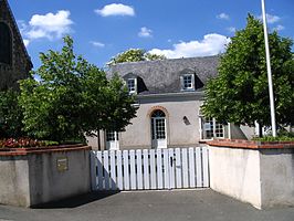 | |||
| Gemeentehuis | |||
| |||

Souvigné-sur-Sarthe is een gemeente in het Franse departement Sarthe (regio Pays de la Loire) en telt 522 inwoners (1999). De plaats maakt deel uit van het arrondissement La Flèche.
Geografie
De oppervlakte van Souvigné-sur-Sarthe bedraagt 16,9 km², de bevolkingsdichtheid is 30,9 inwoners per km².
De onderstaande kaart toont de ligging van Souvigné-sur-Sarthe met de belangrijkste infrastructuur en aangrenzende gemeenten.
 |
Demografie
Onderstaande figuur toont het verloop van het inwonertal (bron: INSEE-tellingen).

Mediabestanden
Zie de categorie Souvigné-sur-Sarthe van Wikimedia Commons voor mediabestanden over dit onderwerp.
- ↑ Populations légales 2021.


