Zinvié
Arrondissement and town in Atlantique Department, Benin
6°37′N 2°21′E / 6.617°N 2.350°E / 6.617; 2.350 Benin
Benin (2013)

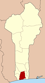
Zinvié is a town and arrondissement in the Atlantique Department of southern Benin. It is an administrative division under the jurisdiction of the commune of Abomey-Calavi. According to the population census conducted by the Institut National de la Statistique Benin on May 11, 2013, the arrondissement had a total population of 18,157.[1] The area contains swampy forest.
References
- ^ Institut National de la Statistique Benin Archived December 17, 2015, at the Wayback Machine, accessed by Geohive, accessed 19 January 2011
- v
- t
- e
Arrondissements of the Atlantique Department- Abomey-Calavi
- Akassato
- Godomey
- Golo-Djigbé
- Hévié
- Kpanroun
- Ouédo
- Togba
- Zinvié
 | This Atlantique Department location article is a stub. You can help Wikipedia by expanding it. |
- v
- t
- e


