Vegelinsoord
Village in Friesland, Netherlands
Vegelinsoord Vegelinsoard | |
|---|---|
Village | |
 Grevensmolen Mill | |
 Location in the former Skarsterlân municipality | |
52°59′57″N 5°51′50″E / 52.99917°N 5.86389°E / 52.99917; 5.86389 | |
| Country |  Netherlands Netherlands |
| Province |  Friesland Friesland |
| Municipality |  De Fryske Marren De Fryske Marren |
| Area | |
| • Total | 16.02 km2 (6.19 sq mi) |
| Elevation | −0.6 m (−2.0 ft) |
| Population (2021)[1] | |
| • Total | 390 |
| • Density | 24/km2 (63/sq mi) |
| Postal code | 8467[1] |
| Dialing code | 0513 |
Vegelinsoord (West Frisian: Vegelinsoard) is a village in De Fryske Marren municipality in the province of Friesland, the Netherlands. It had a population of around 390 in 2017.[3]
There is a windmill in the village, De Deels.
History
The village was first mentioned in 1913 as Stobbegat. In 1958, it changed its name to Vegelinsoord after the Vegelin van Claerbergen [nl] family.[4]
The polder mill De Deels or Grevensmolen is located near the village. The windmill dates from 1860 and has remained in service to drain excess water throughout its existence.[5]
Before 2014, Vegelinsoord was part of the Skarsterlân municipality and before 1984 it was part of Haskerland.[6]
Gallery
-
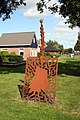 Statue Fean
 -
 Football club Stobbegat


References
- ^ a b c "Kerncijfers wijken en buurten 2021". Central Bureau of Statistics. Retrieved 30 March 2022.
- ^ "Postcodetool for 8467SB". Actueel Hoogtebestand Nederland (in Dutch). Het Waterschapshuis. Retrieved 29 March 2022.
- ^ Kerncijfers wijken en buurten 2017 - CBS
- ^ "Vegelinsoord - (geografische naam)". Etymologiebank (in Dutch). Retrieved 30 March 2022.
- ^ "Grevensmolen". Molen database (in Dutch). Retrieved 30 March 2022.
- ^ "Vegelinsoord". Plaatsengids (in Dutch). Retrieved 30 March 2022.
External links
![]() Media related to Vegelinsoord at Wikimedia Commons
Media related to Vegelinsoord at Wikimedia Commons
- v
- t
- e
Populated places in the municipality of De Fryske Marren
- Joure
- Lemmer
- Sloten
- Former municipalities: Gaasterlân-Sleat
- Lemsterland
- Skarsterlân
- Akmarijp
- Bakhuizen
- Balk
- Bantega
- Boornzwaag
- Broek
- Delfstrahuizen
- Dijken
- Doniaga
- Echten
- Echtenerbrug
- Eesterga
- Elahuizen
- Follega
- Goingarijp
- Harich
- Haskerhorne
- Idskenhuizen
- Kolderwolde
- Langweer
- Legemeer
- Mirns
- Nijehaske
- Nijemirdum
- Oldeouwer
- Oosterzee
- Oudega
- Oudehaske
- Oudemirdum
- Ouwster-Nijega
- Ouwsterhaule
- Rijs
- Rohel
- Rotstergaast
- Rotsterhaule
- Rottum
- Ruigahuizen
- Scharsterbrug
- Sint Nicolaasga
- Sintjohannesga
- Snikzwaag
- Sondel
- Terherne
- Terkaple
- Teroele
- Tjerkgaast
- Vegelinsoord
- Wijckel
 | This Friesland location article is a stub. You can help Wikipedia by expanding it. |
- v
- t
- e


