Torneträsk
Lake in Kiruna municipality in Sweden
You can help expand this article with text translated from the corresponding article in Swedish. (November 2014) Click [show] for important translation instructions.
- Machine translation, like DeepL or Google Translate, is a useful starting point for translations, but translators must revise errors as necessary and confirm that the translation is accurate, rather than simply copy-pasting machine-translated text into the English Wikipedia.
- Do not translate text that appears unreliable or low-quality. If possible, verify the text with references provided in the foreign-language article.
- You must provide copyright attribution in the edit summary accompanying your translation by providing an interlanguage link to the source of your translation. A model attribution edit summary is
Content in this edit is translated from the existing Swedish Wikipedia article at [[:sv:Torneträsk]]; see its history for attribution. - You may also add the template
{{Translated|sv|Torneträsk}}to the talk page. - For more guidance, see Wikipedia:Translation.
→ river Válfojohka
→ lake Gamajávri
→ river Kamajåkka
→ lake Abiskojaure
→ river Abiskojåkka
• river Njuoreatnu
• river Rágeseatnu
• lake Koojärvi
→ river Stalojåkka
• river Nakerijoki
• river Sarvájohka
• river Bessešjohka
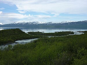
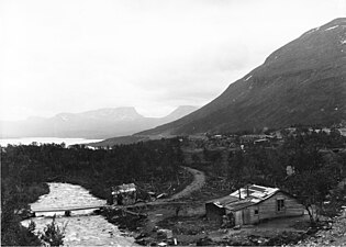
Torneträsk or Torne träsk (Swedish: [toːɳɛˈtrɛsːk];[2] Saami: Duortnosjávri; Finnish and Meänkieli: Tornio or Torniojärvi) is a lake in Kiruna Municipality, Lapland, Norrbotten County in Sweden, in the Scandinavian Mountains. Träsk is the local word for lake (in Standard Swedish it means "swamp"). It is the sixth-largest lake in Sweden, with a total area of 330 square kilometres (130 square miles) and a length of 70 kilometres (43 miles). The lake drains to the south-east through Torne river. South-west of the lake lies the Abisko National Park and the UNESCO World Heritage Site Laponian area.
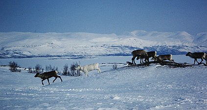
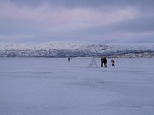
Torneträsk originated from the remnant of a glacier, which has given the lake its depth of 168 metres (551 feet), making it the second-deepest lake in Sweden. It is usually ice-covered from December through June, with variations dependent on temperature variations.
Permafrost is common in the land around the lake. This low elevation permafrost is disappearing because of global warming and increased snowfall.[3]
During the 1944 Operation Obviate of WWII, British bombers seeking to destroy the German battleship Tirpitz had their rendezvous over Torneträsk, in violation of Swedish neutrality.
Climate
| Climate data for Torneträsk 1991-2020 normals (393m) | |||||||||||||
|---|---|---|---|---|---|---|---|---|---|---|---|---|---|
| Month | Jan | Feb | Mar | Apr | May | Jun | Jul | Aug | Sep | Oct | Nov | Dec | Year |
| Mean daily maximum °C (°F) | −6.4 (20.5) | −6.6 (20.1) | −3.0 (26.6) | 2.0 (35.6) | 7.5 (45.5) | 13.6 (56.5) | 17.3 (63.1) | 15.2 (59.4) | 9.8 (49.6) | 2.8 (37.0) | −2.4 (27.7) | −4.5 (23.9) | 3.8 (38.8) |
| Daily mean °C (°F) | −10.1 (13.8) | −10.4 (13.3) | −6.8 (19.8) | −1.7 (28.9) | 3.9 (39.0) | 9.7 (49.5) | 12.9 (55.2) | 11.2 (52.2) | 6.6 (43.9) | 0.2 (32.4) | −5.2 (22.6) | −8.0 (17.6) | 0.2 (32.4) |
| Mean daily minimum °C (°F) | −14.7 (5.5) | −14.9 (5.2) | −11.2 (11.8) | −5.6 (21.9) | 0.4 (32.7) | 5.6 (42.1) | 9.0 (48.2) | 7.4 (45.3) | 3.4 (38.1) | −2.4 (27.7) | −8.8 (16.2) | −12.2 (10.0) | −3.7 (25.4) |
| Average precipitation mm (inches) | 29.5 (1.16) | 23.7 (0.93) | 20.9 (0.82) | 20.4 (0.80) | 36.7 (1.44) | 58.4 (2.30) | 93.1 (3.67) | 65.5 (2.58) | 48.9 (1.93) | 37.6 (1.48) | 29.9 (1.18) | 31.5 (1.24) | 496.1 (19.53) |
| Source: NOAA[4] | |||||||||||||
| Climate data for Rensjön A 1991-2020 normals (494m) | |||||||||||||
|---|---|---|---|---|---|---|---|---|---|---|---|---|---|
| Month | Jan | Feb | Mar | Apr | May | Jun | Jul | Aug | Sep | Oct | Nov | Dec | Year |
| Mean daily maximum °C (°F) | −7.3 (18.9) | −7.3 (18.9) | −3.5 (25.7) | 1.4 (34.5) | 7.2 (45.0) | 13.7 (56.7) | 17.3 (63.1) | 15.0 (59.0) | 9.6 (49.3) | 2.0 (35.6) | −3.6 (25.5) | −5.5 (22.1) | 3.3 (37.9) |
| Daily mean °C (°F) | −12.2 (10.0) | −12.2 (10.0) | −8.4 (16.9) | −3.0 (26.6) | 3.0 (37.4) | 9.0 (48.2) | 12.3 (54.1) | 10.3 (50.5) | 5.4 (41.7) | −1.5 (29.3) | −7.7 (18.1) | −10.1 (13.8) | −1.3 (29.7) |
| Mean daily minimum °C (°F) | −18.0 (−0.4) | −18.1 (−0.6) | −14.3 (6.3) | −8.3 (17.1) | −1.3 (29.7) | 4.6 (40.3) | 7.8 (46.0) | 5.9 (42.6) | 1.4 (34.5) | −5.2 (22.6) | −12.7 (9.1) | −15.6 (3.9) | −6.2 (20.8) |
| Average precipitation mm (inches) | 25.8 (1.02) | 20.7 (0.81) | 18.8 (0.74) | 21.8 (0.86) | 41.3 (1.63) | 57.1 (2.25) | 90.8 (3.57) | 64.3 (2.53) | 48.7 (1.92) | 39.8 (1.57) | 29.9 (1.18) | 29.6 (1.17) | 488.6 (19.25) |
| Source: NOAA[5] | |||||||||||||
Images
|


References
- ^ "Sjöar och vattendrag" (in Swedish). Vattenmyndigheten Bottenviken. Retrieved 2008-09-13.
- ^ Jöran Sahlgren; Gösta Bergman (1979). Svenska ortnamn med uttalsuppgifter (in Swedish). p. 25.
- ^ Johansson, Margareta; Christensen, Torben R.; Akerman, H. Jonas; Callaghan, Terry V. (2006). "What Determines the Current Presence or Absence of Permafrost in the Torneträsk Region, a Sub-arctic Landscape in Northern Sweden?". Ambio: A Journal of the Human Environment. 35 (4): 190–197. doi:10.1579/0044-7447(2006)35[190:WDTCPO]2.0.CO;2. PMID 16944644. S2CID 45127318.
- ^ "NOAA / WMO averages 1991-2020 Torneträsk". SMHI / NOAA. Retrieved 28 August 2023.
- ^ "NOAA / WMO averages 1991-2020 Rensjön A". SMHI / NOAA. Retrieved 28 August 2023.
External links
 Media related to Torneträsk at Wikimedia Commons


