South Huntingdon Township, Pennsylvania
Township in Pennsylvania, United States
South Huntingdon Township, Westmoreland County, Pennsylvania | |
|---|---|
Township | |
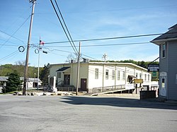 Street scene in Yukon | |
 Map of Westmoreland County, Pennsylvania Highlighting South Huntingdon Township | |
 Map of Pennsylvania highlighting Westmoreland County | |
| Country | United States |
| State | Pennsylvania |
| County | Westmoreland |
| Settled | 1752 |
| Incorporated | 1790 |
| Area | |
| • Total | 45.81 sq mi (118.65 km2) |
| • Land | 45.42 sq mi (117.65 km2) |
| • Water | 0.39 sq mi (1.00 km2) |
| Population (2020)[2] | |
| • Total | 5,412  |
| • Estimate (2021)[2] | 5,374 |
| • Density | 122.49/sq mi (47.29/km2) |
| Time zone | UTC-5 (Eastern (EST)) |
| • Summer (DST) | UTC-4 (EDT) |
| FIPS code | 42-129-72256 |
South Huntingdon Township is a township in Westmoreland County, Pennsylvania, United States. The population was 5,412 at the 2020 census.[2]
History
The Bells Mills Covered Bridge was listed on the National Register of Historic Places in 1980.[3]
Geography
According to the United States Census Bureau, the township has a total area of 45.7 square miles (118 km2), of which 45.3 square miles (117 km2) is land and 0.4 square miles (1.0 km2) (0.98%) is water.
Demographics
| Census | Pop. | Note | %± |
|---|---|---|---|
| 2000 | 6,175 | — | |
| 2010 | 5,796 | −6.1% | |
| 2020 | 5,412 | −6.6% | |
| 2021 (est.) | 5,374 | [2] | −0.7% |
| U.S. Decennial Census[4] | |||
As of the census[5] of 2000, there were 6,175 people, 2,461 households, and 1,840 families living in the township. The population density was 136.4 inhabitants per square mile (52.7/km2). There were 2,585 housing units at an average density of 57.1 units per square mile (22.0 units/km2). The racial makeup of the township was 98.02% White, 0.91% African American, 0.11% Native American, 0.08% Asian, 0.02% Pacific Islander, 0.06% from other races, and 0.79% from two or more races. Hispanic or Latino of any race were 0.37% of the population.
There were 2,461 households, out of which 28.9% had children under the age of 18 living with them, 61.4% were married couples living together, 9.3% had a female householder with no husband present, and 25.2% were non-families. 21.9% of all households were made up of individuals, and 11.6% had someone living alone who was 65 years of age or older. The average household size was 2.51 and the average family size was 2.91.
In the township the population was spread out, with 21.4% under the age of 18, 6.8% from 18 to 24, 29.1% from 25 to 44, 25.9% from 45 to 64, and 16.8% who were 65 years of age or older. The median age was 41 years. For every 100 females there were 96.9 males. For every 100 females age 18 and over, there were 96.1 males.
The median income for a household in the township was $35,431, and the median income for a family was $39,529. Males had a median income of $31,728 versus $23,033 for females. The per capita income for the township was $17,645. About 4.7% of families and 7.1% of the population were below the poverty line, including 5.8% of those under age 18 and 9.4% of those age 65 or over.
-
 Sewickley Presbyterian Church on Bells Mills Road

References
- ^ "2016 U.S. Gazetteer Files". United States Census Bureau. Retrieved August 14, 2017.
- ^ a b c d Bureau, US Census. "City and Town Population Totals: 2020—2021". Census.gov. US Census Bureau. Retrieved July 26, 2022.
- ^ "National Register Information System". National Register of Historic Places. National Park Service. July 9, 2010.
- ^ "Census of Population and Housing". Census.gov. Retrieved June 4, 2016.
- ^ "U.S. Census website". United States Census Bureau. Retrieved January 31, 2008.
- v
- t
- e
Municipalities and communities of Westmoreland County, Pennsylvania, United States
County seat: Greensburg

- Adamsburg
- Arona
- Avonmore
- Bolivar
- Delmont
- Derry
- Donegal
- East Vandergrift
- Export
- Hunker
- Hyde Park
- Irwin
- Laurel Mountain
- Ligonier
- Madison
- Manor
- Mount Pleasant
- Murrysville
- New Alexandria
- New Florence
- New Stanton
- North Belle Vernon
- North Irwin
- Oklahoma
- Penn
- Scottdale
- Seward
- Smithton
- South Greensburg
- Southwest Greensburg
- Sutersville
- Trafford‡
- Vandergrift
- West Leechburg
- West Newton
- Youngstown
- Youngwood
unincorporated
communities
- Acme
- Alverton
- Ardara
- Armbrust
- Baggaley
- Bessemer
- Blackstone
- Boquet
- Bovard
- Brenizer
- Carbon
- Claridge
- Darragh
- Forbes Road
- Greenwald
- Hannastown
- Hopewell
- Hutchinson
- Jacobs Creek
- Jones Mills
- Kecksburg
- Larimer
- Laughlintown
- Lloydsville
- Lowber
- Luxor
- Marguerite
- Morewood
- Moween
- New Derry
- Pandora
- Peanut
- Pleasant Unity
- Reagantown
- Rector
- Reduction
- Rillton
- Ruffs Dale
- Salina
- Scab Hill
- Seger
- Southwest
- Stahlstown
- Standard Shaft
- Tarrs
- Torrance
- Trauger
- Turkeytown
- United
- Wendel
- Westmoreland City
- Whitney
‡This populated place also has portions in an adjacent county or counties
- Pennsylvania portal
- United States portal
| ||||||||||
|---|---|---|---|---|---|---|---|---|---|---|
| Counties |
|  | ||||||||
| Major cities | ||||||||||
| Cities and towns 15k–50k (in 2010) | ||||||||||
| Airports | ||||||||||
| Topics | ||||||||||
| ||||||||||

Authority control databases | |
|---|---|
| International |
|
| National |
|
40°07′00″N 79°41′59″W / 40.11667°N 79.69972°W / 40.11667; -79.69972


