Paris, Mississippi
Census-designated place in Mississippi, United States
34°10′43″N 89°27′35″W / 34.17861°N 89.45972°W / 34.17861; -89.45972 (2020)
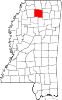
Paris is a census-designated place and unincorporated community in Lafayette County, Mississippi, United States. Paris is located at the junction of Mississippi Highway 9W and Mississippi Highway 315 10 miles (16 km) east of Water Valley.[3]
It was first named as a CDP in the 2020 Census which listed a population of 163.[4]
Demographics
| Census | Pop. | Note | %± |
|---|---|---|---|
| 2020 | 163 | — | |
| U.S. Decennial Census[5] 2020[6] | |||
2020 census
| Race / Ethnicity | Pop 2020[6] | % 2020 |
|---|---|---|
| White alone (NH) | 138 | 84.66% |
| Black or African American alone (NH) | 6 | 3.68% |
| Native American or Alaska Native alone (NH) | 2 | 1.23% |
| Asian alone (NH) | 0 | 0.00% |
| Pacific Islander alone (NH) | 0 | 0.00% |
| Some Other Race alone (NH) | 0 | 0.00% |
| Mixed Race/Multi-Racial (NH) | 12 | 7.36% |
| Hispanic or Latino (any race) | 5 | 3.07% |
| Total | 163 | 100.00% |
Note: the US Census treats Hispanic/Latino as an ethnic category. This table excludes Latinos from the racial categories and assigns them to a separate category. Hispanics/Latinos can be of any race.
Education
It is in the Lafayette County School District.[7]
Notable person
- Theora Hamblett, Mississippi artist, was born in Paris.[8]
References
- ^ "2020 U.S. Gazetteer Files". United States Census Bureau. Retrieved July 24, 2022.
- ^ "Paris". Geographic Names Information System. United States Geological Survey, United States Department of the Interior.
- ^ Lafayette County, Mississippi General Highway Map (PDF) (Map). Mississippi Department of Transportation. 2008. Retrieved August 15, 2012.[permanent dead link]
- ^ "Paris CDP, Mississippi". United States Census Bureau. Retrieved March 13, 2022.
- ^ "Decennial Census of Population and Housing by Decades". US Census Bureau.
- ^ a b "P2 HISPANIC OR LATINO, AND NOT HISPANIC OR LATINO BY RACE - 2020: DEC Redistricting Data (PL 94-171) - Paris CDP, Mississippi". United States Census Bureau.
- ^ "2020 CENSUS - SCHOOL DISTRICT REFERENCE MAP: Lafayette County, MS" (PDF). U.S. Census Bureau. Retrieved July 21, 2022. - Text list
- ^ University of Mississippi collections-Theora Hamblett
- v
- t
- e
Municipalities and communities of Lafayette County, Mississippi, United States
County seat: Oxford
- Paris
- Tula
- University
communities
- Mississippi portal
- United States portal
 | This Lafayette County, Mississippi state location article is a stub. You can help Wikipedia by expanding it. |
- v
- t
- e


