Nahavand County
County in Hamadan province, Iran
County in Hamadan, Iran
Nahavand County Persian: شهرستان نهاوند | |
|---|---|
County | |
 | |
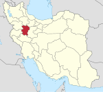
 Location of Nahavand County in Hamadan province (bottom, green) | |
 Location of Hamadan province in Iran | |
| Coordinates: 34°13′N 48°13′E / 34.217°N 48.217°E / 34.217; 48.217[1] | |
| Country | Iran |
| Province | Hamadan |
| Capital | Nahavand |
| Districts | Central, Giyan, Khezel, Zarrin Dasht |
| Population (2016)[2] | |
| • Total | 178,787 |
| Time zone | UTC+3:30 (IRST) |
| Nahavand County can be found at GEOnet Names Server, at this link, by opening the Advanced Search box, entering "9207369" in the "Unique Feature Id" form, and clicking on "Search Database". | |
Nahavand County (Persian: شهرستان نهاوند) is in Hamadan province, Iran. Its capital is the city of Nahavand.[3]
Demographics
Population
At the time of the 2006 National Census, the county's population was 178,683 in 46,283 households.[4] The following census in 2011 counted 181,711 people in 53,821 households.[5] At the 2016 census, the county's population was 178,787 in 55,542 households.[2]
Administrative divisions
Nahavand County's population history and administrative structure over three consecutive censuses are shown in the following table.
| Administrative Divisions | 2006[4] | 2011[5] | 2016[2] |
|---|---|---|---|
| Central District | 116,092 | 119,191 | 117,270 |
| Gamasiyab RD | 14,597 | 14,983 | 13,616 |
| Shaban RD | 15,321 | 15,250 | 14,321 |
| Tariq ol Eslam RD | 13,956 | 13,513 | 13,171 |
| Nahavand (city) | 72,218 | 75,445 | 76,162 |
| Giyan District | 17,253 | 17,811 | 17,027 |
| Giyan RD | 2,705 | 3,038 | 2,863 |
| Sarab RD | 6,486 | 6,671 | 5,978 |
| Giyan (city) | 8,062 | 8,102 | 8,186 |
| Khezel District | 30,903 | 30,081 | 29,968 |
| Khezel-e Sharqi RD | 12,926 | 11,706 | 11,538 |
| Solgi RD | 13,923 | 13,740 | 13,257 |
| Firuzan (city) | 4,054 | 4,635 | 5,173 |
| Zarrin Dasht District | 14,435 | 14,112 | 13,046 |
| Fazl RD | 4,268 | 4,042 | 3,731 |
| Garin RD | 7,438 | 7,375 | 6,858 |
| Barzul (city) | 2,729 | 2,695 | 2,457 |
| Total | 178,683 | 181,711 | 178,787 |
| RD = Rural District | |||
See also
![]() Media related to Nahavand County at Wikimedia Commons
Media related to Nahavand County at Wikimedia Commons
References
- ^ OpenStreetMap contributors (19 October 2023). "Nahavand County" (Map). OpenStreetMap. Retrieved 19 October 2023.
- ^ a b c "Census of the Islamic Republic of Iran, 1395 (2016)". AMAR (in Persian). The Statistical Center of Iran. p. 13. Archived from the original (Excel) on 21 April 2021. Retrieved 19 December 2022.
- ^ Habibi, Hassan (21 June 1369). "Approval of the organization and chain of citizenship of the elements and units of the country's divisions of Hamadan province, centered in Hamadan city". Lamtakam (in Persian). Ministry of Interior, Political Defense Commission of the Government Board. Archived from the original on 11 February 2024. Retrieved 11 February 2024.
- ^ a b "Census of the Islamic Republic of Iran, 1385 (2006)". AMAR (in Persian). The Statistical Center of Iran. p. 13. Archived from the original (Excel) on 20 September 2011. Retrieved 25 September 2022.
- ^ a b "Census of the Islamic Republic of Iran, 1390 (2011)". Syracuse University (in Persian). The Statistical Center of Iran. p. 13. Archived from the original (Excel) on 17 January 2023. Retrieved 19 December 2022.
- v
- t
- e
Hamadan Province, Iran
| Asadabad County | |
|---|---|
| Bahar County | |
| Famenin County | |
| Hamadan County | |
| Kabudarahang County | |
| Malayer County | |
| Nahavand County | |
| Qorveh-e Darjazin County | |
| Razan County | |
| Tuyserkan County |
- Ganjnameh
- Shrine of Habakkuk, Toyserkan
- Hamedan Stone Lion
- Ali Sadr Cave
- Hamedan Museum of Natural History
- Noshijan fire temple,Malayer
- Shrine of Esther and Mordechai, Hamedan
- Baba Taher Mausleum, Hamedan
- Avicenna mausoleum, Hamedan
- Emamzadeh Yahya,Hamedan
- Alvand ski resort
- Pirsolayman lagoon
- Median capital of Hegmataneh, Hamedan
- Ecbatan dam
- Geyan lagoon
- Baba-pireh shrine
- Ecbatana


