Mongyawng State
| Mongyawng State | |||||||||
|---|---|---|---|---|---|---|---|---|---|
| State of the Shan States | |||||||||
| 18th century–1815 | |||||||||
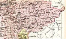 Möng Yawng in an Imperial Gazetteer of India map | |||||||||
| History | |||||||||
• Foundation of the state | 18th century | ||||||||
• Annexed by Kengtung State | 1815 | ||||||||
| |||||||||
Mongyawng or Möngyawng was one of the Shan states. It was located in the narrow wedge of territory that projects eastwards from Kengtung State between China and Laos.[1]
History
Mongyawng State was founded in the 18th century. It had its capital at Mong Yawng town. The state was inhabited mainly by Wa people.[2]
The state was occupied by Siam until 1814 and subsequently annexed by Kengtung State in 1815.[3]
Rulers
The rulers of Mongyawng had the title Myoza.[3]
- c.17.. - 17.. Tao Luk
- 17.. - 17.. Tao Ngam
- 17.. - 17.. Sunabnta
- 17.. - 17.. Sulang Ka Wutti
- (17.. - .... Inta Wasai
- .... - .... ....
- .... - .... Hsai Ya Kuman I
- .... - .... Hsen Sulin (Surin Pumintha)
- .... - .... Hsai Ya Kuman II
- .... - .... Sao Yawt
- 1814 - 1815 Maha Hkanan
- 1815 Buddha Wong
See also
- Mong Yawng Yazawin
References
External links
- The Tai Of the Shan State
- The Imperial Gazetteer of India
- "WHKMLA : History of the Shan States". 18 May 2010. Retrieved 21 December 2010.
- v
- t
- e
- Hsenwi State
- Mongmit
- Hsipaw
- North Hsenwi
- South Hsenwi
- Hsumhsai
- Manglon
- Mongleng
- Monglong
- Mongtung
- Tawngpeng
Eastern Division
Central Division
Myelat Division
Kengtung & Yawnghwe
- Federated Shan states
- List of rulers of Shan states
- Princely state
- Saopha
21°11′N 100°22′E / 21.183°N 100.367°E / 21.183; 100.367
 | This Burmese history article is a stub. You can help Wikipedia by expanding it. |
- v
- t
- e
 | This Shan State location article is a stub. You can help Wikipedia by expanding it. |
- v
- t
- e


