Meja, Kranj
Place in Upper Carniola, Slovenia
46°11′28.7″N 14°22′35.23″E / 46.191306°N 14.3764528°E / 46.191306; 14.3764528 Slovenia
 (2002)
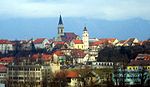
Meja (pronounced [ˈmɛːja]) is a small settlement near Mavčiče in the Municipality of Kranj in the Upper Carniola region of Slovenia.[2]
Name
The name Meja means 'border'. The name refers to the location of the village along the road from Jeprca to Kranj, which largely corresponded to the western border of the Dominion of Škofja Loka from 973 to 1803.[3][4]
References
- ^ Statistical Office of the Republic of Slovenia Archived November 18, 2008, at the Wayback Machine
- ^ Kranj municipal site
- ^ Blaznik, Pavle (1973). Škofja Loka in loško gospostvo (973–1803). Škofja Loka: Muzejsko društvo. p. 14.
- ^ Savnik, Roman (1968). Krajevni leksikon Slovenije, vol. 1. Ljubljana: Državna založba Slovenije. p. 163.
External links
 Media related to Meja at Wikimedia Commons
- Meja on Geopedia
- v
- t
- e
Administrative seat: Kranj
| Current |
|
|---|---|
| Former |

- Kieselstein Castle
- Kokra River Canyon
- Lake Trboje
- Plečnik Steps
- Schrottenturn Manor
- St. Cantianus and Companions Parish Church
- St. Judoc's Church
- St. Margaret's Hill
- Šum Falls
- Udin Woods
- Janez Bleiweis
- Davorin Dolar
- Lojze Dolinar
- Primož Grašič
- Boštjan Hladnik
- Simon Jenko
- Leopold Layer
- Peter Lipar
- Janez Mencinger
- Franc Novak
- Jože Plečnik
- Marko Pogačnik
- Ivan Pregelj
- Marij Pregelj
- France Prešeren
- Johann Pucher
- Edvard Ravnikar
- Andrej Šifrer
- Hinko Smrekar
- Marjan Šorli
- Andrej Štremfelj
- Tone Volčič


