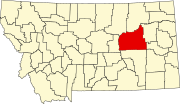
List of lakes of Garfield County, Montana
Map all coordinates using OpenStreetMap
Download coordinates as:
- KML
- GPX (all coordinates)
- GPX (primary coordinates)
- GPX (secondary coordinates)
This list is incomplete; you can help by adding missing items. (January 2011) |
There are at least 34 named lakes and reservoirs in Garfield County, Montana.
Lakes
Reservoirs
- Antone Reservoir, 46°54′05″N 106°33′50″W / 46.90139°N 106.56389°W / 46.90139; -106.56389 (Antone Reservoir), el. 2,920 feet (890 m)[1]
- Birkrem Reservoir, 46°53′58″N 107°00′10″W / 46.89944°N 107.00278°W / 46.89944; -107.00278 (Birkrem Reservoir), el. 3,212 feet (979 m)[2]
- Buffalo Hill Reservoir, 47°33′48″N 106°42′02″W / 47.56333°N 106.70056°W / 47.56333; -106.70056 (Buffalo Hill Reservoir), el. 2,612 feet (796 m)[3]
- Burgess Reservoir, 47°29′39″N 106°26′03″W / 47.49417°N 106.43417°W / 47.49417; -106.43417 (Burgess Reservoir), el. 2,425 feet (739 m)[4]
- Cedar Bed Ground Reservoir, 47°24′23″N 106°18′40″W / 47.40639°N 106.31111°W / 47.40639; -106.31111 (Cedar Bed Ground Reservoir), el. 2,402 feet (732 m)[5]
- Christenson Reservoir, 46°55′33″N 106°31′04″W / 46.92583°N 106.51778°W / 46.92583; -106.51778 (Christenson Reservoir), el. 2,828 feet (862 m)[6]
- Clear Water Reservoir, 46°51′15″N 106°29′39″W / 46.85417°N 106.49417°W / 46.85417; -106.49417 (Clear Water Reservoir), el. 2,874 feet (876 m)[7]
- Cottonwood Reservoir, 47°27′09″N 106°24′10″W / 47.45250°N 106.40278°W / 47.45250; -106.40278 (Cottonwood Reservoir), el. 2,365 feet (721 m)[8]
- Cottonwood Tree Lakes, 46°53′17″N 106°54′32″W / 46.88806°N 106.90889°W / 46.88806; -106.90889 (Cottonwood Tree Lakes), el. 3,133 feet (955 m)[9]
- Ezekial Reservoir, 47°12′27″N 107°50′22″W / 47.20750°N 107.83944°W / 47.20750; -107.83944 (Ezekial Reservoir), el. 2,871 feet (875 m)[10]
- Ezwkial Number One Reservoir, 47°13′01″N 107°53′05″W / 47.21694°N 107.88472°W / 47.21694; -107.88472 (Ezwkial Number One Reservoir), el. 2,812 feet (857 m)[11]
- Fisher Reservoir, 47°25′07″N 106°26′54″W / 47.41861°N 106.44833°W / 47.41861; -106.44833 (Fisher Reservoir), el. 2,464 feet (751 m)[12]
- Fork Reservoir, 47°26′43″N 106°24′38″W / 47.44528°N 106.41056°W / 47.44528; -106.41056 (Fork Reservoir), el. 2,415 feet (736 m)[13]
- Fourteen Reservoir, 46°53′04″N 107°00′41″W / 46.88444°N 107.01139°W / 46.88444; -107.01139 (Fourteen Reservoir), el. 3,159 feet (963 m)[14]
- Guesanborn Reservoir, 47°02′30″N 107°08′50″W / 47.04167°N 107.14722°W / 47.04167; -107.14722 (Guesanborn Reservoir), el. 2,963 feet (903 m)[15]
- Gumbo Reservoir, 47°26′11″N 106°29′28″W / 47.43639°N 106.49111°W / 47.43639; -106.49111 (Gumbo Reservoir), el. 2,575 feet (785 m)[16]
- Jade Reservoir, 47°31′08″N 106°58′52″W / 47.51889°N 106.98111°W / 47.51889; -106.98111 (Jade Reservoir), el. 2,720 feet (830 m)[17]
- Krieder Reservoir, 47°05′42″N 107°28′54″W / 47.09500°N 107.48167°W / 47.09500; -107.48167 (Krieder Reservoir), el. 3,173 feet (967 m)[18]
- Mashesky Reservoir, 47°10′55″N 107°44′43″W / 47.18194°N 107.74528°W / 47.18194; -107.74528 (Mashesky Reservoir), el. 2,841 feet (866 m)[19]
- McKrone Reservoir, 47°29′39″N 107°01′51″W / 47.49417°N 107.03083°W / 47.49417; -107.03083 (McKrone Reservoir), el. 2,851 feet (869 m)[20]
- McWilliams Reservoir, 46°57′18″N 106°25′08″W / 46.95500°N 106.41889°W / 46.95500; -106.41889 (McWilliams Reservoir), el. 2,700 feet (820 m)[21]
- Mud Lake, 46°53′06″N 106°57′51″W / 46.88500°N 106.96417°W / 46.88500; -106.96417 (Mud Lake), el. 3,156 feet (962 m)[22]
- Mullory Reservoir, 47°26′07″N 106°26′36″W / 47.43528°N 106.44333°W / 47.43528; -106.44333 (Mullory Reservoir), el. 2,480 feet (760 m)[23]
- Murnions Reservoir, 47°20′18″N 106°32′14″W / 47.33833°N 106.53722°W / 47.33833; -106.53722 (Murnions Reservoir), el. 2,487 feet (758 m)[24]
- Old Lake, 46°53′17″N 106°56′12″W / 46.88806°N 106.93667°W / 46.88806; -106.93667 (Old Lake), el. 3,130 feet (950 m)[25]
- Section Four Reservoir, 46°54′45″N 106°32′42″W / 46.91250°N 106.54500°W / 46.91250; -106.54500 (Section Four Reservoir), el. 2,864 feet (873 m)[26]
- Shaw Reservoir, 46°57′00″N 107°53′24″W / 46.95000°N 107.89000°W / 46.95000; -107.89000 (Shaw Reservoir), el. 2,625 feet (800 m)[27]
- Split Reservoir, 47°13′06″N 107°45′16″W / 47.21833°N 107.75444°W / 47.21833; -107.75444 (Split Reservoir), el. 2,897 feet (883 m)[28]
- Steel Mule Reservoir, 47°11′34″N 107°37′18″W / 47.19278°N 107.62167°W / 47.19278; -107.62167 (Steel Mule Reservoir), el. 3,002 feet (915 m)[29]
- Stroud Reservoir, 47°10′54″N 107°42′53″W / 47.18167°N 107.71472°W / 47.18167; -107.71472 (Stroud Reservoir), el. 2,913 feet (888 m)[30]
- Ten Reservoir, 46°53′53″N 107°01′44″W / 46.89806°N 107.02889°W / 46.89806; -107.02889 (Ten Reservoir), el. 3,232 feet (985 m)[31]
- Thomas Reservoir, 47°25′36″N 106°27′37″W / 47.42667°N 106.46028°W / 47.42667; -106.46028 (Thomas Reservoir), el. 2,467 feet (752 m)[32]
- Wheatcroft Reservoir, 47°15′00″N 107°19′10″W / 47.25000°N 107.31944°W / 47.25000; -107.31944 (Wheatcroft Reservoir), el. 2,884 feet (879 m)[33]
- York Reservoir, 47°14′23″N 106°41′24″W / 47.23972°N 106.69000°W / 47.23972; -106.69000 (York Reservoir), el. 2,684 feet (818 m)[34]
See also
Notes
- ^ "Antone Reservoir". Geographic Names Information System. United States Geological Survey, United States Department of the Interior.
- ^ "Birkrem Reservoir". Geographic Names Information System. United States Geological Survey, United States Department of the Interior.
- ^ "Buffalo Hill Reservoir". Geographic Names Information System. United States Geological Survey, United States Department of the Interior.
- ^ "Burgess Reservoir". Geographic Names Information System. United States Geological Survey, United States Department of the Interior.
- ^ "Cedar Bed Ground Reservoir". Geographic Names Information System. United States Geological Survey, United States Department of the Interior.
- ^ "Christenson Reservoir". Geographic Names Information System. United States Geological Survey, United States Department of the Interior.
- ^ "Clear Water Reservoir". Geographic Names Information System. United States Geological Survey, United States Department of the Interior.
- ^ "Cottonwood Reservoir". Geographic Names Information System. United States Geological Survey, United States Department of the Interior.
- ^ "Cottonwood Tree Lakes". Geographic Names Information System. United States Geological Survey, United States Department of the Interior.
- ^ "Ezekial Reservoir". Geographic Names Information System. United States Geological Survey, United States Department of the Interior.
- ^ "Ezwkial Number One Reservoir". Geographic Names Information System. United States Geological Survey, United States Department of the Interior.
- ^ "Fisher Reservoir". Geographic Names Information System. United States Geological Survey, United States Department of the Interior.
- ^ "Fork Reservoir". Geographic Names Information System. United States Geological Survey, United States Department of the Interior.
- ^ "Fourteen Reservoir". Geographic Names Information System. United States Geological Survey, United States Department of the Interior.
- ^ "Guesanborn Reservoir". Geographic Names Information System. United States Geological Survey, United States Department of the Interior.
- ^ "Gumbo Reservoir". Geographic Names Information System. United States Geological Survey, United States Department of the Interior.
- ^ "Jade Reservoir". Geographic Names Information System. United States Geological Survey, United States Department of the Interior.
- ^ "Krieder Reservoir". Geographic Names Information System. United States Geological Survey, United States Department of the Interior.
- ^ "Mashesky Reservoir". Geographic Names Information System. United States Geological Survey, United States Department of the Interior.
- ^ "McKrone Reservoir". Geographic Names Information System. United States Geological Survey, United States Department of the Interior.
- ^ "McWilliams Reservoir". Geographic Names Information System. United States Geological Survey, United States Department of the Interior.
- ^ "Mud Lake". Geographic Names Information System. United States Geological Survey, United States Department of the Interior.
- ^ "Mullory Reservoir". Geographic Names Information System. United States Geological Survey, United States Department of the Interior.
- ^ "Murnions Reservoir". Geographic Names Information System. United States Geological Survey, United States Department of the Interior.
- ^ "Old Lake". Geographic Names Information System. United States Geological Survey, United States Department of the Interior.
- ^ "Section Four Reservoir". Geographic Names Information System. United States Geological Survey, United States Department of the Interior.
- ^ "Shaw Reservoir". Geographic Names Information System. United States Geological Survey, United States Department of the Interior.
- ^ "Split Reservoir". Geographic Names Information System. United States Geological Survey, United States Department of the Interior.
- ^ "Steel Mule Reservoir". Geographic Names Information System. United States Geological Survey, United States Department of the Interior.
- ^ "Stroud Reservoir". Geographic Names Information System. United States Geological Survey, United States Department of the Interior.
- ^ "Ten Reservoir". Geographic Names Information System. United States Geological Survey, United States Department of the Interior.
- ^ "Thomas Reservoir". Geographic Names Information System. United States Geological Survey, United States Department of the Interior.
- ^ "Wheatcroft Reservoir". Geographic Names Information System. United States Geological Survey, United States Department of the Interior.
- ^ "York Reservoir". Geographic Names Information System. United States Geological Survey, United States Department of the Interior.