Leibertingen
You can help expand this article with text translated from the corresponding article in German. (February 2009) Click [show] for important translation instructions.
- View a machine-translated version of the German article.
- Machine translation, like DeepL or Google Translate, is a useful starting point for translations, but translators must revise errors as necessary and confirm that the translation is accurate, rather than simply copy-pasting machine-translated text into the English Wikipedia.
- Do not translate text that appears unreliable or low-quality. If possible, verify the text with references provided in the foreign-language article.
- You must provide copyright attribution in the edit summary accompanying your translation by providing an interlanguage link to the source of your translation. A model attribution edit summary is
Content in this edit is translated from the existing German Wikipedia article at [[:de:Leibertingen]]; see its history for attribution. - You may also add the template
{{Translated|de|Leibertingen}}to the talk page. - For more guidance, see Wikipedia:Translation.
Municipality in Baden-Württemberg, Germany

Coat of arms
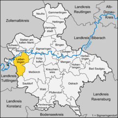
Location of Leibertingen within Sigmaringen district
(2021–29) Stephan Frickinger[1]
(2022-12-31)[2]
88637
Leibertingen is a municipality in the district of Sigmaringen in Baden-Württemberg, Germany.
Geography
Geographical location
Leibertingen is located 600 to 850 meters above sea level directly over the Danube valley in the Heuberg region, a plateau at the southern bound corner of the Swabian Jura, with a distance of 22 km to Sigmaringen and 24 km to Tuttlingen and belongs to the Naturpark Obere Donau. Of the total area of around 4720 hectares (as of Dec. 31 2010[3]), 2127 hectare are forest, 2328 hectare are farmland and 257 hectares consist of residential and circulation areas.[4] The so-called "Dreiländereck" (Eng. border triangle) is located underneath the nearby Wildenstein mountain. This is where Württemberg (Irndorf parish), Hohenzollern-Sigmaringen (Beuron parish) and Baden (Leibertingen parish) come together.
Municipality
Leibertingen forms the name-giving municipality with the adjoining villages of Altheim, Kreenheinstetten and Thalheim.
| Coat of arms | Villages | Inhabitants (2008) | Area |
|---|---|---|---|
 | Leibertingen (main locality) | 681 | 1729 ha |
 | Altheim | 250 | 456 ha |
 | Kreenheinstetten | 651 | 1588 ha |
 | Thalheim | 666 | 947 ha |
Administration
Leibertingen forms with the neighboring towns of Sauldorf and Meßkirch an association of its municipal administration.
History
In historic documents Leibertingen was mentioned in the year 1275 for the first time; Altheim however already in the year 768, and Kreenheinstetten in 793.
Demographics
Population development:[5]
|
Economy
Transport
Architecture, people and yearly events
Historical buildings
- Burg Wildenstein
Notable people
- Abraham a Sancta Clara (1644–1709) born at Kreenheinstetten
Yearly events
- The "Wildensteiner Jahrmarkt"
Sport
- Leibertingen harbors a gliding airfield, where during the year various events take place.
References
- ^ Aktuelle Wahlergebnisse, Staatsanzeiger, accessed 15 September 2021.
- ^ "Bevölkerung nach Nationalität und Geschlecht am 31. Dezember 2022" [Population by nationality and sex as of December 31, 2022] (CSV) (in German). Statistisches Landesamt Baden-Württemberg. June 2023.
- ^ Angaben nach Auskunft aus dem Vorzimmer des Bürgermeisters der Gemeinde Leibertingen, vom 12. Januar 2011.
- ^ http://www.leibertingen.de/ Homepage der Gemeinde
- ^ "Leibertingen (Sigmaringen, Baden-Württemberg, Deutschland) - Einwohnerzahlen, Grafiken, Karte, Lage, Wetter und Web-Informationen". citypopulation.de. Retrieved 2023-06-19.
- Christoph Schmider & Edwin Ernst Weber: Kommunale und kirchliche Archivpflege im ländlichen Raum: Geschichte, Probleme und Perspektiven am Beispiel des Gemeinde- und Pfarrarchivs Kreenheinstetten. Heimatkundliche Schriftenreihe des Landkreises Sigmaringen, Band 5. Saulgau: Gebr. Edel & Co., 1997. ISBN 3-931634-01-9.
External links
Wikimedia Commons has media related to Leibertingen.
- Official Homepage of Leibertingen
- Naturpark Obere Donau
- v
- t
- e
Towns and municipalities in Sigmaringen (district)

Authority control databases | |
|---|---|
| International |
|
| National |
|
 | This Sigmaringen district location article is a stub. You can help Wikipedia by expanding it. |
- v
- t
- e


