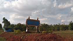
Hsi Hseng
Hsi Hseng ဆီဆိုင်မြို့, ဝေင်ꩻသီႏသဲင်ႏ | |
|---|---|
Town | |
 | |
| 20°9′N 97°15′E / 20.150°N 97.250°E / 20.150; 97.250 | |
| Country |  Myanmar Myanmar |
| State |  Shan State Shan State |
| Districts | Taunggyi District |
| Township | Hsi Hseng Township |
| Control |  / / Joint Pa-O National Liberation Army and Karenni Nationalities Defence Force control Joint Pa-O National Liberation Army and Karenni Nationalities Defence Force control |
| Time zone | UTC+6.30 (MST) |
Hsi Hseng or Hsi-hseng (Burmese: ဆီဆိုင်မြို့) (Pa'o Karen: ဝေင်ꩻသီႏသဲင်ႏ(ဝေင်ꩻသထွုံႏပေႏ)) is a town in the Shan State of eastern Burma. It is located in Hsi Hseng Township in Taunggyi District and lies along National Highway 5. It is connected to Loikaw in the South and Taunggyi in the south.[1] The area is a known producer of opium and methamphetamine; poppy fields and a methamphetamine factory have been reported in Hsi Hseng.[2] Gee Dong was killed near Hsi Hseng in 1974.[3] People there are mostly Pa-Oh and some are Shan but Burmese are increasing now on 2023.

Although sources differ, Hsi Hseng is also considered to be the town where Pa'O musician Khun Thar Doon was murdered in 1978 by Pa'O communists.[4]
In January 2024, the town came under attack by a joint force of the Pa-O National Liberation Organization and the Karenni Nationalities Defense Force.[5]
References
- ^ Maps (Map). Google Maps.
- Bing Maps (Map). Microsoft and Harris Corporation Earthstar Geographics LLC. - ^ British Broadcasting Corporation. Monitoring Service (1996). Summary of world broadcasts: Asia, Pacific. British Broadcasting Corporation. Retrieved 28 September 2011.
- Lintner, Bertil (1999). Burma in revolt: opium and insurgency since 1948. Silkworm Press. ISBN 978-974-7100-78-5. Retrieved 28 September 2011.
- International Campaign to Ban Landmines (2002). Landmine monitor report 2002: toward a mine-free world. Human Rights Watch. p. 628. ISBN 978-1-56432-277-7. Retrieved 28 September 2011. - ^ Christensen, Russ; Ṅhakʻ, Chūʺ (2006). The Pa-O: rebels and refugees. Silkworm Books. p. 32. ISBN 978-974-9575-93-2. Retrieved 28 September 2011.
- ^ "Taunggyitime's Profile - the Music Hutch - Upload Music. Search Music. Share Music. Listen to Music".
- ^ Wei, Brian (January 26, 2024). "Myanmar Military Now at War With Ethnic Pa-O Army And Allies in Southern Shan State". The Irrawaddy.
External links
- Satellite map at Maplandia.com
- v
- t
- e
 | This Shan State location article is a stub. You can help Wikipedia by expanding it. |
- v
- t
- e


