Cuatro Vientos
City neighborhood in Madrid, Community of Madrid, Spain
Cuatro Vientos | |
|---|---|
 | |
 | |
| Country | Spain |
| Region | Community of Madrid |
| Municipality | Madrid |
| District | Latina |
 | |
Cuatro Vientos is an administrative neighborhood (barrio) of Madrid belonging to the district of Latina.
Geography
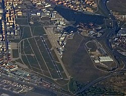
Cuatro Vientos is situated in the south-western area of central Madrid, close to the motorways A5 and M40 and to the homonymous airport.
External links
- Cuatro Vientos on Google Maps
- Infos about the "Museo del Aire"
- v
- t
- e
Districts and wards of Madrid
- Atocha
- Imperial
- La Chopera
- Las Acacias
- Las Delicias
- Legazpi
- Palos de Moguer


- Aeropuerto
- Alameda de Osuna
- Casco Histórico de Barajas
- Corralejos
- Timón
- Abrantes
- Buenavista
- Comillas
- Opañel
- Puerta Bonita
- San Isidro
- Vista Alegre
- Cortes
- Embajadores
- Justicia
- Universidad
- Palacio
- Sol
- Castilla
- Ciudad Jardín
- El Viso
- Hispanoamérica
- Nueva España
- Prosperidad
- Almagro
- Arapiles
- Gaztambide
- Ríos Rosas
- Trafalgar
- Vallehermoso
- Atalaya
- Colina
- Concepción
- Pinar de Chamartín
- Pueblo Nuevo
- Quintana
- San Juan Bautista
- San Pascual
- Ventas
- Barrio del Pilar
- El Goloso
- El Pardo
- Fuentelarreina
- La Paz
- Mirasierra
- Peñagrande
- Valverde
- Apóstol Santiago
- Canillas
- Palomas
- Pinar del Rey
- Piovera
- Valdefuentes
- Aluche
- Campamento
- Cuatro Vientos
- Las Águilas
- Lucero
- Los Cármenes
- Puerta del Ángel
- Aravaca
- Argüelles
- Casa de Campo
- Ciudad Universitaria
- El Plantío
- Valdemarín
- Valdezarza
- Fontarrón
- Horcajo
- Marroquina
- Media Legua
- Pavones
- Vinateros
- Entrevías
- Numancia
- Palomeras Bajas
- Palomeras Sureste
- Portazgo
- San Diego
- Adelfas
- Estrella
- Ibiza
- Jerónimos
- Niño Jesús
- Pacífico
- Castellana
- Fuente del Berro
- Goya
- Guindalera
- Lista
- Recoletos
- Amposta
- Arcos
- Canillejas
- Hellín
- Rejas
- Rosas
- Salvador
- Simancas
- Almenara
- Bellas Vistas
- Berruguete
- Castillejos
- Cuatro Caminos
- Valdeacederas
- Almendrales
- Moscardó
- Orcasitas
- Orcasur
- Pradolongo
- San Fermín
- Zofío
- Ambroz
- Casco Histórico de Vicálvaro
- Casco Histórico de Vallecas
- Santa Eugenia
- Butarque
- Los Ángeles
- Los Rosales
- San Cristóbal de los Ángeles
- Villaverde Alto
40°22′39″N 3°47′28″W / 40.37750°N 3.79111°W / 40.37750; -3.79111
 | This article about a location in the Community of Madrid, Spain is a stub. You can help Wikipedia by expanding it. |
- v
- t
- e


