Coipasa Lake
Lake and associated salida in Bolivia
19°12′S 68°07′W / 19.200°S 68.117°W / -19.200; -68.117
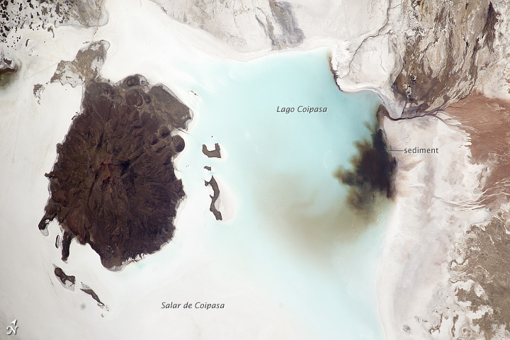
Lago Coipasa or Salar de Coipasa is a lake in Sabaya Province, Oruro Department, Bolivia. At an elevation of 3657 m, its surface area is 806 km². It is on the western part of Altiplano, 20 km north of Salar de Uyuni and south of the main road linking Oruro and Huara (Chile).[1]
Lake Coipasa is a tectonic[clarification needed] saline lake with a depth of 3.5 metres that is surrounded by the Coipasa salt flat (Salar de Coipasa), and the volcanic cone of the 4,920 m high Wila Pukarani.
Thousands of flamingos have settled on the shores of Lake Coipasa.
Gallery
-
 Map of the shape and depth (bathymetry) of the Coipasa lake, 2020
 -
 The lake
 -
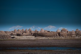 The village of Chipaya, Oruro, Bolivia, near the lake


See also
- Chipaya
- Ouki
References
- ^ "Travel map of the Andes". Nelles Map. Archived from the original on 2010-09-24. Retrieved 2010-12-10.
External links
 Media related to Salar de Coipasa at Wikimedia Commons
- Salar de Coipasa (Map). Archived from the original on 31 May 2014. Retrieved 31 May 2014.
- www
.boliviatravelsite .com /attractions .php?attraction=Coipasa+Lake - gsabulletin
.gsapubs .org /content /118 /5-6 /515 .abstract
- v
- t
- e
Lakes on the Altiplano
- Lake Titicaca
- Lake Poopó
- Salar de Uyuni
- Salar de Coipasa
- Lake Ballivián
- Cabana
- Mataro
- Lake Tauca
- Sajsi
- Lake Minchin
- Salinas
- Inca Huasi
- Ouki
- Lake Escara
 Lakes portal
| Authority control databases: National |
|
|---|
This Oruro Department location article is a stub. You can help Wikipedia by expanding it. |
- v
- t
- e


