Cheongyang County
County in Hoseo, South Korea
Cheongyang  Flag Emblem of Cheongyang | |
|---|---|
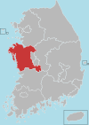
 Location in South Korea | |
| Country |  South Korea South Korea |
| Region | Hoseo |
| Administrative divisions | 1 eup, 9 myeon |
| Area | |
| • Total | 479.57 km2 (185.16 sq mi) |
| Population (2003) | |
| • Total | 37,194 |
| • Density | 77.6/km2 (201/sq mi) |
| • Dialect | Chungcheong |
Cheongyang County (Korean: 청양군; RR: Cheongyang-gun) is a county in South Chungcheong Province, South Korea. A predominantly rural area, it is known throughout Korea for the spicy Cheongyang chili peppers which are grown there. Another noted local specialty is the fruit of the gugija. The county is home to Cheongyang Provincial College.
Climate
Cheongyang has a humid continental climate (Köppen: Dwa), but can be considered a borderline humid subtropical climate (Köppen: Cwa) using the −3 °C (27 °F) isotherm.
| Climate data for Cheongyang (1993–2020 normals) | |||||||||||||
|---|---|---|---|---|---|---|---|---|---|---|---|---|---|
| Month | Jan | Feb | Mar | Apr | May | Jun | Jul | Aug | Sep | Oct | Nov | Dec | Year |
| Mean daily maximum °C (°F) | 3.3 (37.9) | 6.1 (43.0) | 11.8 (53.2) | 18.4 (65.1) | 23.9 (75.0) | 27.5 (81.5) | 29.3 (84.7) | 30.2 (86.4) | 26.1 (79.0) | 20.5 (68.9) | 12.9 (55.2) | 5.3 (41.5) | 17.9 (64.2) |
| Daily mean °C (°F) | −2.5 (27.5) | −0.2 (31.6) | 4.8 (40.6) | 11.0 (51.8) | 16.8 (62.2) | 21.4 (70.5) | 24.9 (76.8) | 25.2 (77.4) | 19.9 (67.8) | 13.0 (55.4) | 6.2 (43.2) | −0.4 (31.3) | 11.7 (53.1) |
| Mean daily minimum °C (°F) | −8.1 (17.4) | −6.1 (21.0) | −1.9 (28.6) | 4.0 (39.2) | 10.1 (50.2) | 15.9 (60.6) | 21.0 (69.8) | 21.1 (70.0) | 14.8 (58.6) | 6.6 (43.9) | 0.4 (32.7) | −5.8 (21.6) | 6.0 (42.8) |
| Average precipitation mm (inches) | 21.8 (0.86) | 34.1 (1.34) | 44.7 (1.76) | 84.1 (3.31) | 90.1 (3.55) | 134.4 (5.29) | 290.4 (11.43) | 296.6 (11.68) | 143.4 (5.65) | 65.1 (2.56) | 54.9 (2.16) | 31.8 (1.25) | 1,291.4 (50.84) |
| Average precipitation days (≥ 0.1 mm) | 5.4 | 4.4 | 6.2 | 6.8 | 6.9 | 7.3 | 13.2 | 12.4 | 7.6 | 5.3 | 7.9 | 7.2 | 90.6 |
| Source: Korea Meteorological Administration[1] | |||||||||||||
Notable people
- Kim Hye-soo – actress
- Hong Seok-cheon – host, actor
- Lee Chun-hee – actor
- Song Yo-chan - Lieutenant General, politician, and former acting Prime Minister of South Korea.
Twin towns – sister cities
Cheongyang is twinned with:
- Yeongdeungpo-gu, Seoul
- Seocho-gu, Seoul
- Gangdong-gu, Seoul
- Mapo-gu, Seoul
- Geumcheon-gu, Seoul
- Ansan, Gyeonggi
- Gunpo, Gyeonggi
- Dong-gu, Daejeon
References
- ^ "Climatological Normals of Korea (1991 ~ 2020)" (PDF) (in Korean). Korea Meteorological Administration. Archived from the original (PDF) on 29 January 2022. Retrieved 7 June 2023.
External links
- County government website
36°27′04″N 126°48′16″E / 36.4511111211°N 126.804444454°E / 36.4511111211; 126.804444454
 | This South Korea location article is a stub. You can help Wikipedia by expanding it. |
- v
- t
- e


