Chato Volcano

Volcano in Costa Rica
Chato Volcano is located in Costa Rica
Chato Volcano
Chato Volcano
Costa Rica
Parent rangeGuanacaste CordilleraGeologyMountain typeStratovolcanoLast eruption~3500 years ago

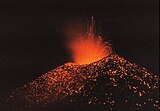
Chato Volcano, sometimes called "Cerro Chato" (Spanish for "Flat Hill"), is an inactive volcano in northwestern Costa Rica northwest of San José, in the province of Alajuela, canton of San Carlos, and district of La Fortuna. It is southeast of the nearby Arenal Volcano.

Cerro Chato is believed to have first erupted 38,000 years ago during the Pleistocene period and last erupted about 3,500 years ago. One of the lava flows is now the route for La Fortuna Waterfall. The hill has two peaks, named Chatito ("little Chato") and Espina ("thorn"). A crater about 500 metres (1,600 ft) wide is filled with green water, making the Laguna Cerro Chato.

Cerro Chato Volcano, on the left, as seen from La Fortuna. Arenal Volcano is seen on the right.

Hiking

The Costa Rican government has closed the trail to Cerro Chato, making it illegal to climb. This law was passed in 1998 but was not enforced until 2017, encouraging hikers, tour operators and business owners to sell this attraction and tour. When it was open it was considered a difficult hike and only recommended for hikers in good physical condition. When it rains, the path becomes muddy and even more treacherous, especially when descending into the crater itself. The environmental damage the illegal hiking has caused is the main cause of the closure.

References

  • [ Profile of Chato Volcano at Costa Rica's Seismic National Network]
  • Basic limnology of fifty-one lakes in Costa Rica (contains some information on Laguna Cerro Chato)
  • "Arenal". Global Volcanism Program. Smithsonian Institution.
  • v
  • t
  • e
Volcanoes of Costa Rica
Cordillera de Guanacaste
  • flagCosta Rica portal
Cordillera de Tilarán
Cordillera Central
  • v
  • t
  • e
Mountains of Costa Rica
  • Agua Gata
  • Anunciación
  • Arenal
  • Azufrado
  • Barva
  • Cerro Barrera
  • Bijagua
  • Cerro Bola
  • Braum
  • Cerro Cacao
  • Cacho Negro
  • Caldera de Miravalles
  • Cañas Dulces
  • Cerro Cedral
  • Cerro Buenos Aires
  • Cerro de la Muerte
  • Cerro de Las Vueltas
  • Cerros de Escazú
  • Chachaguita
  • Chato
  • Chirripó
  • Chompipe
  • Coco Mountain
  • Cocorí Mountain
  • Concepción Mountain
  • Congo Mountain
  • Coronel Mountain
  • Coto Pelón
  • Cotón
  • Crestones (Costa Rica)
  • Dikar
  • Doussaints
  • Duan Mountains
  • Durika
  • Echandi
  • El Hacha
  • El Jaboncillo
  • Espiritu Santo Mountain
  • Fortuna Mountain
  • Gorgona Mountain
  • Iglesias
  • Irazú
  • Juan Murillo Mountain
  • Kámuk
  • Laguna Bosque Alegre
  • Laguna Poco Sol
  • Laguna Rio IV
  • Loma Barrantes
  • Loma Morera
  • Lomas
  • Los Chiles
  • Mano de Tigre
  • Miravalles
  • Monte de la Cruz
  • Montezuma Mountain
  • Morazán Mountain
  • Negro
  • Olla de Carne
  • Orosí
  • Palmira Mountain
  • Pasquí
  • Pata de Gallo
  • Pelado y Delicias
  • Pelón
  • Perdidos
  • Pico Alto
  • Pico Blanco
  • Piedra de Fuego
  • Platanar
  • Poás
  • Porvenir
  • Quemados
  • Quezada Mountain
  • Rabo de Mico
  • Rincón (Costa Rica)
  • Rincón de la Vieja
  • San Miguel
  • San Roque Mountain
  • San Vicente Mountain
  • Santa Maria Mountain
  • Siete
  • Sinsal
  • Tenorio
  • Tilarán
  • Tortuguero Mountain
  • Truncado
  • Turrialba
  • Urán
  • Valle Hermoso Mountain
  • Ventisqueros
  • Viejo
  • Von Francius
  • Von Seebach
  • Vuelta Kopper
  • Weyl Mountain
  • flagCosta Rica portal
  • v
  • t
  • e
Guatemala
El Salvador
  • Chinameca
  • Chingo
  • Conchagua
  • Izalco
  • Santa Ana
  • San Miguel
  • San Salvador
  • San Vicente
  • Usulután
Nicaragua
Costa Rica
Panama
Note: volcanoes are ordered from north-west to south-east.