Cerro Negro de Mayasquer
Volcano on the border of Colombia and Ecuador

Cerro Negro de Mayasquer
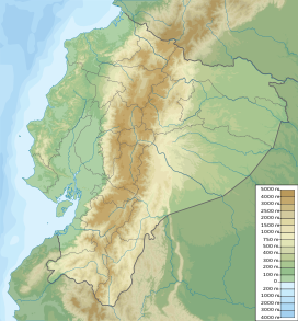
Location of Cerro Negro de Mayasquer in Colombia & Ecuador
 Colombia
Carchi
 Ecuador
Cordillera Real
Andes
Cerro Negro de Mayasquer is a volcano on the border of Colombia and Ecuador. It lies 3 kilometres (2 mi) north-west of the volcano Chiles, and the two peaks are considered part of the same Chiles-Cerro Negro volcanic complex. These volcanoes, together with Cumbal are andesitic in rock type.[2] A 1936 eruption reported by the Colombian government agency INGEOMINAS may have been from the Ecuadorean volcano Reventador, otherwise the volcano has not erupted for around 160,000 years.[1]
See also
References
- ^ a b c d "Chiles-Cerro Negro". Global Volcanism Program. Smithsonian Institution. Retrieved May 2, 2011.
- ^ Plancha 447-447bis, 2003
Bibliography
- Parra, Eduardo, and Marta Velásquez. 2003. Plancha 447 Ipiales & 447bis Tallambí - 1:100,000, 1. INGEOMINAS. Accessed 2017-06-06.
Further reading
- Monsalve B., María Luisa, and Carlos Andrés Laverde C. 2016. Contribución al registro de actividad de los volcanes Chiles y Cerro Negro (frontera colombo-ecuatoriana). Boletín de Geología, Universidad Industrial de Santander 38. 61-78. Accessed 2017-06-15.
- v
- t
- e


- Alto Mellizos
- Las Ánimas
- Bordoncillo
- Cerro Bravo
- Cerro Machín
- Doña Juana
- El Escondido
- Galeras
- Morasurco
- Nevado El Cisne
- Nevado del Huila
- Nevado del Quindío
- Nevado del Ruiz
- Nevado de Santa Isabel
- Nevado del Tolima
- Patascoy
- Petacas
- Puracé
- Romeral
- San Diego
- Sotará
- • "Observatorios Vulcanológicos". Servicio Geológico de Colombia.
 Category • Images
 | This Colombian location article is a stub. You can help Wikipedia by expanding it. |
- v
- t
- e
 | This South America mountain, mountain range, or peak related article is a stub. You can help Wikipedia by expanding it. |
- v
- t
- e


