Bishopville, Maryland
Census-designated place in Maryland, United States
38°26′33″N 75°11′37″W / 38.44250°N 75.19361°W / 38.44250; -75.19361 (2020)
21813
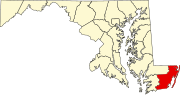
Bishopville is an unincorporated community and census-designated place 10 miles (16 km) north of Berlin in Worcester County, Maryland, United States. The community is just south of the Delaware state line. It is part of the Salisbury, Maryland-Delaware Metropolitan Statistical Area. As of the 2010 census, Bishopville had a population of 531.[3]
Bishopville arose at the site of a mill on and crossing of the Bishopville Prong of the St. Martin's River. The crossing, the main road through the community, is now Maryland Route 367.
Demographics
| Census | Pop. | Note | %± |
|---|---|---|---|
| 2020 | 499 | — | |
| U.S. Decennial Census[4] | |||
References
- ^ "2020 U.S. Gazetteer Files". United States Census Bureau. Retrieved April 26, 2022.
- ^ "Bishopville". Geographic Names Information System. United States Geological Survey, United States Department of the Interior.
- ^ "U.S. Census website". United States Census Bureau. Retrieved January 7, 2016.
- ^ "Census of Population and Housing". Census.gov. Retrieved June 4, 2016.
External links
Wikimedia Commons has media related to Bishopville, Maryland.
- Bishopville-St. Martin's Neck Community Association
- v
- t
- e
Municipalities and communities of Worcester County, Maryland, United States
County seat: Snow Hill
- Bishopville
- Girdletree
- Newark
- Ocean Pines
- Stockton
- West Ocean City
- Whaleyville
communities
‡This populated place also has portions in an adjacent county or counties
- Maryland portal
- United States portal


