Bay of Vlorë
Bay in Albania bordering the Adriatic Sea
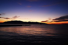
40°27′0″N 19°24′0″E / 40.45000°N 19.40000°E / 40.45000; 19.40000The Bay of Vlorë (Albanian: Gjiri i Vlorës — Albanian pronunciation: [ˈɟiːɾi i ˈvlɔːɾəs]) is a large bay of the Adriatic Sea situated along the Albanian Adriatic Sea Coast on the Mediterranean Sea in Southern Europe. It opens to the sea in the northwest and is largely surrounded by the lagoon of Narta in the north, the city of Vlorë in the northeast, the mountains of the Ceraunians in the east and southeast, and the peninsula of Karaburun in the southwest and west.
Biodiversity
The bay is categorized as an Important Bird and Plant Area by virtue of it provides excellent habitats for a vast array of bird and plant species.[1][2]
Geography
The Karaburun Peninsula, which stretches at the meetingpoint of the Adriatic and Ionian Sea, encompasses the western shoreline of the bay that is highly hilly and irregular in structure and is home to the Karaburun-Sazan Marine Park.[3]
History
In classical antiquity the Bay of Vlorë constituted the southern limit of the Illyrian coast.[4][5][6][7] The Bay is delimited by the mountainous area of the Karaburun Peninsula (ancient Akrokeraunia) to the southwest and the Ceraunian Mountains to the south, which represented a natural frontier separating Illyria from Epirus.[4][6][5] The coastal area of the Bay was settled by Ancient Greek colonists, who traditionally founded Oricum, Thronion and Aulon.[8][9][10] Illyrians were found in the hinterland of the Bay.[11][6][7] The area at the foot of the Akrokeraunian Mountains including the Dukat plain in the south of the Bay was inhabited by the southernmost Illyrians, while Chaones and their territory, Chaonia, were located to the south of the Akrokeraunia.[4][12]
In Roman times, the region was a significant place and was the scene, for example, of some of Caesar's battles. It has been suggested that Julius Caesar landed inside the Bay of Vlorë from Brundusium across the Adriatic, in order to carry on the Civil War against Pompey in Illyricum and the oncoming Battle of Dyrrhachium on 10 July 48 BC.[13] Ptolemy mentions Aulon (Vlorë), locating it in Taulantian territory.[14]
In one account, 18 ships full of merchandise have sunk in the Bay. Studying the Bay of Vlorë, it has been one of the main projects of the navigation department of the University of Vlora in the last few years.[15] The southwestern end of the Bay, at the naval base of Pashaliman, has been used as a harbor since antiquity. The city was called Oricum. During the Cold War, it was temporarily a Soviet naval base, the only one in the Mediterranean sea.[citation needed]
|


See also
References
- ^ BirdLife International. "Vlora Bay, Karaburun Peninsula and Cika mountain". datazone.birdlife.org. p. 1.
- ^ IUCN, World Wide Fund for Nature, Plantlife. "Important Plant Areas of the south and east Mediterranean region" (PDF). portals.iucn.org. p. 75.
{{cite web}}: CS1 maint: multiple names: authors list (link) - ^ "Management Plan for National Marine Park Karaburun-Sazan" (PDF). mcpa.iwlearn.org. p. 10.
- ^ a b c Shpuza 2022, p. 553.
- ^ a b Zindel et al. 2018, p. 346.
- ^ a b c Bejko et al. 2015, p. 4.
- ^ a b Hammond & Wilkes 2012, p. 726.
- ^ Cabanes 2008, p. 171.
- ^ Malkin 2001, pp. 192–193.
- ^ Papadopoulos 2016, p. 440.
- ^ De Simone 2017, p. 1867: "According to Hammond and Wilkes (...) the Illyrians were “a large group of related Indo-European tribes, who occupied in classical times the western side of the Balkan range from the head of the Adriatic Sea to the hinterland of the Gulf of Valona and extended northwards as far as the eastern Alps and the Danube and eastwards into some districts beyond the Balkan range.”"
- ^ Bejko et al. 2015, p. 4: "As for where precisely in this topography of tribes of southern Illyria and Epirus Lofkend lies, there is no clear confirmation, except that the region is north of the Epirote tribes and thus in southern Illyria. The tumulus is located somewhat to the north of ancient Chaonia—usually located between the Thyamis River in Greek Epirus (the mod-ern Kalamas) and the Akrokeraunian headland, the modern Karaburun peninsula that defines the western edge of the bay of Vlorë, the ancient Aulon, in Albania (...)—and to the north and west of Atintania (...)."
- ^ Longhurst 2016, p. 132: "The most significant problem is the identification of Caesar’s landing place for his army with Palaeste, when it can be shown that he probably landed inside the Gulf of Valona." 134: "Pompey’s army was dispersed in winter quarters leaving his main supply base of Dyrrachium (Durazzo or Durrës) potentially vulnerable to a surprise attack. Caesar planned to land his army on the coast of Illyricum (Albania), as near as he could to Dyrrachium, march on the city and seize Pompey’s supplies."
- ^ Jaupaj 2019, p. 81.
- ^ "UNIVERSITETI I VLORES 'Ismail Qemali' – Virtus Scientia Veritas". Univlora.edu.al. Archived from the original (PDF) on 2014-02-03. Retrieved 2013-04-22.
Bibliography
- Bejko, Lorenc; Morris, Sarah; Papadopoulos, John; Schepartz, Lynne (2015). The Excavation of the Prehistoric Burial Tumulus at Lofkend, Albania. ISD LLC. ISBN 978-1938770524.
- Cabanes, Pierre (2008). "Greek Colonisation in the Adriatic". In Tsetskhladze, Gocha R. (ed.). Greek Colonisation: An Account of Greek Colonies and Other Settlements Overseas. Vol. 2. Brill. pp. 155–186. ISBN 9789047442448.
- De Simone, Carlo (2017). "Illyrian". In Klein, Jared; Joseph, Brian; Fritz, Matthias (eds.). Handbook of Comparative and Historical Indo-European Linguistics. Vol. 3. Walter de Gruyter. pp. 1867–1872. ISBN 978-3-11-054243-1.
- Hammond, N. G. L.; Wilkes, J. J. (2012). "Illyrii". In Hornblower, Simon; Spawforth, Antony; Eidinow, Esther (eds.). The Oxford Classical Dictionary. OUP Oxford. p. 726. ISBN 978-0-19-954556-8.
- Jaupaj, Lavdosh (2019). Etudes des interactions culturelles en aire Illyro-épirote du VII au III siècle av. J.-C (Thesis). Université de Lyon; Instituti i Arkeologjisë (Albanie).
- Longhurst, Ian (2016). "Caesar's Crossing of the Adriatic Countered by a Winter Blockade During the Roman Civil War". The Mariner's Mirror. 102 (2). Routledge: 132–152. doi:10.1080/00253359.2015.1054681. S2CID 163921681.
- Malkin, Irad (2001). "Greek Ambiguities: Between "Ancient Hellas" and "Barbarian Epirus"". In Malkin, Irad (ed.). Ancient Perceptions of Greek Ethnicity. Center for Hellenic Studies colloquia. Vol. 5. Center for Hellenic Studies, Trustees for Harvard University. pp. 187–212. ISBN 978-0-674-00662-1.
- Papadopoulos, John (2016). "Komai, Colonies and Cities in Epirus and Southern Albania: The Failure of the Polis and the Rise of Urbanism on the Fringes of the Greek World". In Molloy, Barry P.C. (ed.). Of Odysseys and Oddities: Scales and Modes of Interaction Between Prehistoric Aegean Societies and their Neighbours. Oxbow Books. pp. 435–460. ISBN 978-1-78570-232-7.
- Shpuza, Saimir (2022). "D'un limên à une polis. Orikos aux périodes archaïque et classique". In Brancato, Rodolfo (ed.). Schemata: la città oltre la forma : per una nuova definizione dei paesaggi urbani e delle loro funzioni: urbanizzazione e società nel Mediterraneo pre-classico : età arcaica. Edizioni Quasar. ISBN 9788854912755.
- Zindel, Christian; Lippert, Andreas; Lahi, Bashkim; Kiel, Machiel (2018). Albanien: Ein Archäologie- und Kunstführer von der Steinzeit bis ins 19. Jahrhundert (in German). Vandenhoeck & Ruprecht. ISBN 9783205200109.
- v
- t
- e
- Administration
- Geography
- Infrastructure
- Culture
- Muradie Mosque
- Kaninë Castle
- Zvërnec Island
- Narta Lagoon
- Oricum
- Flamurtari Stadium
- University of Vlorë
- Independence Monument
- Flag's Square
| Authority control databases |
|
|---|
 | This article about a specific location in Vlorë County, Albania, is a stub. You can help Wikipedia by expanding it. |
- v
- t
- e


