Bakovnik
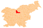
Place in Upper Carniola, Slovenia
46°12′33″N 14°35′59″E / 46.20917°N 14.59972°E / 46.20917; 14.59972 Slovenia
Bakovnik (pronounced [ˈbaːkɔu̯nik], German: Bakounik[1][2]) is a former settlement in the Municipality of Kamnik in central Slovenia. It is now part of the town of Kamnik. The area is part of the traditional region of Upper Carniola. The municipality is now included in the Central Slovenia Statistical Region.
Geography
Bakovnik lies south of Kamnik, between Duplica and Perovo, above the right bank of the Kamnik Bistrica River.
History
Bakovnik was annexed by Kamnik in 1934, ending its existence as an independent settlement.[3][4] Bakovnik quickly urbanized after its annexation and lost its original agricultural character.[5]
References
- ^ Special-Orts-Repertorium von Krain. Vienna: Alfred Hölder. 1884. p. 139.
- ^ Intelligenzblatt zur Laibacher Zeitung, no. 141. November 24, 1849, p. 19.
- ^ Krajevni leksikon Dravske Banovine. 1937. Ljubljana: Zveza za tujski promet za Slovenijo, p. 184.
- ^ Savnik, Roman (1971). Krajevni leksikon Slovenije, vol. 2. Ljubljana: Državna založba Slovenije. p. 179.
- ^ Klemenčič, Viktor (1953). "Urbanizacija okolice Kamnika". Geografski vestnik. 25: 73–92.
External links
 Media related to Bakovnik at Wikimedia Commons
- Bakovnik on Geopedia
- v
- t
- e
Municipality of Kamnik
Administrative seat: Kamnik
- Big Pasture Plateau
- Kamnik Bistrica Valley
- Kamnik Parish Church
- Little Castle
- Menina Pasture Plateau
- Nevljica
- Snovik Spa
- St. Primus' Church
- Tuhinj Valley
- Tunjice Natural Health Resort
- Volčji Potok Arboretum
- Zaprice Castle


