Babare
Village/Neighborhood in Dolakha District, Bagmati Province
Babare बाबरे | |
|---|---|
Village/Neighborhood | |
 Babare village | |
27°46′N 86°07′E / 27.77°N 86.12°E / 27.77; 86.12 | |
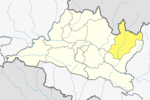
| Country |  Nepal Nepal |
| Province | Bagmati Province |
| District | Dolakha District |
| Rural Municipality | Kalinchowk Rural Municipality |
| Ward No. | 2 |
| Government | |
| • Type | Ward council |
| • councillor | Nani Pandey |
| • Ward Secretary | Gigmi Tamang |
| Area | |
| • Total | 16.67 km2 (6.44 sq mi) |
| Population (2011) | |
| • Total | 3,533 |
| • Density | 210/km2 (550/sq mi) |
| Time zone | UTC+5:45 (Nepal Time) |
| Website | kalinchowkmun |
Babare (Nepali: बाबरे) is a village (previously: VDC) in Kalinchowk Rural Municipality in Dolakha District in the Bagmati Province of north-eastern Nepal. At the time of the 1991 Nepal census it had a population of 3,392 people living in 739 individual households.[1]
This village is now a ward (ward no. 2) of Kalinchowk Rural Municipality. It has 16.67 square kilometres (6.44 sq mi) of area and total population according to 2011 Nepal census is 3,533 Individuals.[2][3]
References
- ^ "Nepal Census 2001", Nepal's Village Development Committees, Digital Himalaya, archived from the original on 12 October 2008, retrieved 15 November 2009.
- ^ "District Corrected Last for RAJAPATRA" (PDF). www.mofald.gov.np. Retrieved 17 July 2018.
- ^ "स्थानीय तहहरुको विवरण" [Details of the local level bodies]. www.mofald.gov.np/en (in Nepali). Ministry of Federal Affairs and Local Development. Retrieved 17 July 2018.
External links
- UN map of the municipalities of Dolakha District
- v
- t
- e
Dolakha District • (Hq :Charikot)
Local level body | |
|---|---|
| Municipalities | |
| Rural municipalities |
|
Former VDCs | |
|---|---|
|
 | This article about a location in the Dolakha District of Nepal is a stub. You can help Wikipedia by expanding it. |
- v
- t
- e


