Anhalt-Bitterfeld
District in Saxony-Anhalt, Germany

Flag
Coat of arms

(31 December 2022)[1]
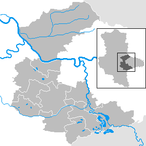
Anhalt-Bitterfeld is a district in Saxony-Anhalt, Germany. Its capital is Köthen (Anhalt). Its area is 1,455.1 km2 (561.8 sq mi).[2]
History
This district was established by merging the former districts of Bitterfeld, Köthen and a large part of Anhalt-Zerbst as part of the reform of 2007.
Former Verwaltungsgemeinschaft
- Osternienburg, disbanded in 2010.
- Raguhn, disbanded in 2010.
Towns and municipalities
The district Anhalt-Bitterfeld consists of the following subdivisions:[3]
| Towns | Municipalities |
|---|---|
|
|
References
- ^ "Bevölkerung der Gemeinden – Stand: 31. Dezember 2022" (PDF) (in German). Statistisches Landesamt Sachsen-Anhalt. June 2023.
- ^ "Tabellen Bodenfläche". Statistisches Landesamt Sachsen-Anhalt. Retrieved 20 November 2022.
- ^ "Gebietsinformationen". Statistisches Landesamt Sachsen-Anhalt. Archived from the original on 2017-05-15. Retrieved 2009-08-06.
![]() Media related to Landkreis Anhalt-Bitterfeld at Wikimedia Commons
Media related to Landkreis Anhalt-Bitterfeld at Wikimedia Commons
- v
- t
- e


- Dessau-Roßlau
- Halle (Saale)
- Magdeburg
- Altmarkkreis Salzwedel
- Anhalt-Bitterfeld
- Börde
- Burgenlandkreis
- Harz
- Jerichower Land
- Mansfeld-Südharz
- Saalekreis
- Salzlandkreis
- Stendal
- Wittenberg
- Anhalt-Zerbst
- Aschersleben-Staßfurt
- Bernburg
- Bitterfeld
- Bördekreis
- Burgenlandkreis
- Halberstadt
- Köthen
- Mansfelder Land
- Merseburg-Querfurt
- Ohrekreis
- Quedlinburg
- Saalkreis
- Sangerhausen
- Schönebeck
- Weißenfels
- Wernigerode
51°43′N 12°4′E / 51.717°N 12.067°E / 51.717; 12.067
Authority control databases | |
|---|---|
| International |
|
| National |
|
 | This Anhalt-Bitterfeld location article is a stub. You can help Wikipedia by expanding it. |
- v
- t
- e


