Achada Santo António
Neighbourhood in Praia, Santiago Island, Cape Verde
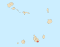
14°54′33″N 23°31′02″W / 14.9093°N 23.5171°W / 14.9093; -23.5171 (2010)
7603
Achada Santo António is a subdivision of the city of Praia in the island of Santiago, Cape Verde. Its population was 12,965 at the 2010 census.[1] It is situated near the Atlantic coast, southwest of the city centre.


Adjacent neighbourhoods are Várzea to the north, Gamboa or Chã das Areias to the northeast, the beach area of Prainha to the east and also where much of the embassies are located, Quebra Canela to the south, Tira Chapéu to the west and Terra Branca to the north.
Landmarks and points of interest
- Chapel of Santo António (Saint Anthony)
- Protestant Church
- École Internationale Les Alizés, a French school
- Institute of Paedagogics
References
- ^ "2010 Census results Santiago". Instituto Nacional de Estatística Cabo Verde (in Portuguese). 24 November 2016.
- v
- t
- e
City of Praia
- Achada Grande Frente
- Achada Grande Tras
- Achada Santo António
- Achadinha
- Bairro Craveiro Lopes
- Calabaceira
- Chã de Areia
- Fazenda
- Lem Ferreira
- Palmarejo
- Plateau
- Ponta de Água
- Prainha
- Quebra Canela
- São Francisco
- Terra Branca
- Tira Chapéu
- Várzea
- Vila Nova

- Cape Verdean National Archives (ANCV)
- Museu Etnográfico da Praia
- National Auditorium
- National Library of Cape Verde
- Quintal da Música
- Tabanka
- Capture of Santiago (1585)
- Battle of Porto Praya (1780)
- Cape Verde
- Barlavento
- Santiago
- Praia


